Elena guest house
Belogradchik
Call us: +359 886 / 572-918
БГ EN

Eco-trails

Belogradchik and its surroundings are good country for day walks, trekking and cycling. The marked eco-routes lead to the most interesting places of the area; each has its own colour.

Marker of eco-trail No. 1: a yellow band on white

Eco-trail No. 1, yellow

The Belogradchik Rocks

Time
4 hours
Difficulty
easy, on laid-out paths
You need
none
You see
the central massif of the Belogradchik Rocks
  1. Tourist information centre
  2. History Museum
  3. Belogradchik fortress
  4. Subashin spring
  5. Natural History Museum
  6. The TV tower
Marker of eco-trail No. 2: a green band on white

Eco-trail No. 2, green

Planinitsa

Time
4 hours
Difficulty
moderate, on laid-out paths
You need
a guide and hiking equipment
You see
the eastern massif of the Belogradchik Rocks
  1. Tourist information centre
  2. Resting place
  3. Haydushko Kladenche spring
  4. Picnic place at Planinitsa
  5. The tourist base at Planinitsa
  6. Chukata
  7. Belogradchik
Marker of eco-trail No. 3: a blue band on white

Eco-trail No. 3, blue

Zbegove

Time
6 hours
Difficulty
moderate, on laid-out paths
You need
a guide and hiking equipment
You see
the western massif of the Belogradchik Rocks
  1. Tourist information centre
  2. Belogradchik fortress
  3. Razkrasie
  4. The Zbegove rocks
  5. Popskata Kashta (rest)
  6. Belogradchik fortress
Marker of eco-trail No. 4: a red band on white

Eco-trail No. 4, red

Vedernik peak

Time
6 hours
Difficulty
moderate, on laid-out paths
You need
a guide and hiking equipment
  1. Tourist information centre
  2. Belogradchik fortress
  3. Razkrasie
  4. Ivanov Kamak (picnic place)
  5. Stolove
  6. Vedernik peak
  7. Zaren
  8. The village of Prauzhda
Marker of eco-trail No. 5: an orange band on white

Eco-trail No. 5, orange

The world of the rocks

Time
6 hours
Difficulty
easy, on laid-out paths
You need
none
You see
the central massif of the Belogradchik Rocks
  1. Mislen Kamak viewing platform
  2. Chachin Kamak viewing platform
  3. Natural History Museum
  4. Markashnitsa viewing platform
  5. Lepenitsa cave
  6. Subashin shelter
  7. Belogradchik fortress
Marker of eco-trail No. 6: an ochre band on white

Eco-trail No. 6, ochre

North-western Balkan

Time
9 days, 150 km
  1. Berkovitsa
  2. Kom peak
  3. The village of Chereshovitsa
  4. The village of Govezhda
  5. Areshkova Chuka / Kopren
  6. Chiprovtsi
  7. The village of Gorni Lom
  8. Bekinska Shobarka / Chuprene
  9. The village of Stakevtsi
  10. Belogradchik

Map of the eco-trails

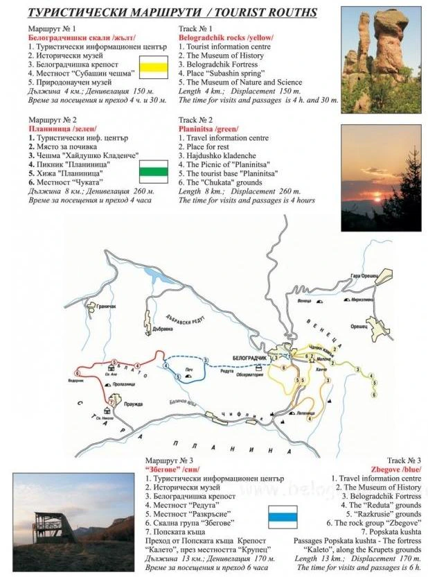
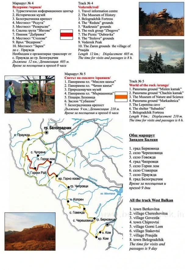
The leaflet “Tourist routes” from the old site of the house, in two parts, in Bulgarian and English. Select it to see it large. It also gives the length and the climb of every route; for routes 1 and 4 its time is longer than the one given above: 4 h 30 min and 8 hours.

  • The leaflet “Tourist routes”: routes 1, 2 and 3 described, with a map of the eco-trails around Belogradchik
    Routes 1, 2 and 3 around Belogradchik
  • The leaflet “Tourist routes”: routes 4 and 5 described, with a map of the long route “West Balkan”
    Routes 4 and 5 and the long route “West Balkan”
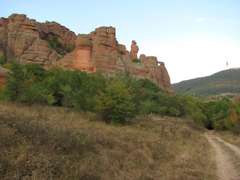
A path across a meadow under the rocks

“Neither the famous narrows of Ollioules in Provence, nor the Pancorbo gorge in Spain, nor the Alps, nor the wild mountains of Tyrol and Switzerland have anything that can be compared with what I saw in Bulgaria at Belogradchik.”

Jérôme Blanqui

The landmarks along the trails

Call to ask for a free room

Tell us when you arrive, for how many nights and how many you are. Ivan Ivanov answers the phone.

Privacy